


The Rallier Papers
- Regular price
- €64.000,00 EUR
- Regular price
-
- Sale price
- €64.000,00 EUR
- Unit price
- per
32 manuscripts, drawings and maps
of the engineer-geographers of Saint-Domingue (Haiti).
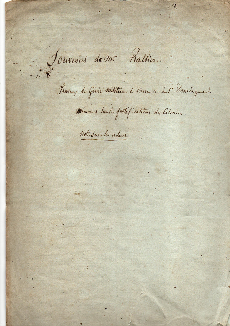
A major late 18th century collection of primary colonial source material on colonial Haiti, Dominica and pro-slavery discourse, assembled by royal colonial engineer Louis Rallier.
This collection brings together thirty-two manuscript parts that formed part of the working world of the French colonial engineers in Saint-Domingue. Until the late eighteenth century, much of the colony remained poorly mapped, and these papers form part of the first serious efforts to survey Saint-Domingue systematically. Military treatises, reconnaissance memoranda, engineering reports, and manuscript maps document how the colony was measured, mapped, defended, and managed in the decades before the Haitian Revolution. They also include detailed reconnaissance of the neighbouring British island of Dominica and plans for its projected invasion.
The core of the papers is associated with Louis-Anne-Esprit Rallier, royal colonial engineer in the southern district from 1787, and includes earlier materials transmitted from senior figures such as Mathias Henri de Moulceau, directeur général des fortifications de Saint-Domingue, and the engineer Moreau. Rallier was a member of the Council of Ancients of Saint-Domingue, one of the two legislative bodies of the French Directory, alongside the Council of Five Hundred. The latter proposed laws, while the Council of Ancients approved or rejected them. After his return to France in the 1790s Rallier became politically engaged, as reflected in a group of manuscripts in this collection that address slavery, colonial governance, and the revolutionary crisis. He published two tracts on the rights of formerly enslaved people after the Haitian Revolution, of which the first is included in this lot.
At the centre of the collection are several substantial, unpublished defence manuscripts that treat Saint-Domingue as a connected military and geographical system, analysing coasts, ports, mountains, and interior routes and proposing coordinated strategies of fortification and movement. Around these are operational notes on landing sites and campaigns, administrative files from the engineering office at Les Cayes, urban and hydraulic projects, and reflective memoranda touching on resources, climate, and reform. Taken together, the papers show the colonial engineer at work as surveyor, strategist, and administrator, and preserve the internal language through which Saint-Domingue was conceptualised and governed on the eve of Revolution.
Names: Louis-Anne-Esprit Rallier (1749–1829); Jean-Baptiste-Marie-Charles-François de Pontleroy (1728–1807); Mathias Henri de Moulceau (active 1760s–1770s); Moreau (active c. 1760s–1787).
Condition: the collection is generally in very good condition.
Literature: Glénisson, Jean-Louis. La cartographie de Saint-Domingue dans la seconde moitié du XVIIIe siècle (de 1763 à la Révolution). 1986. École nationale de Chartes, thesis.
Scope and content
• Detailed military memoranda setting out a comprehensive system for the defence of Saint-Domingue, including a report of a coastal cartographic survey. We have located manuscript maps that are based on these surveys.
• Reports, drawings, and administrative records from the southern engineering office, including plans of Les Cayes and the 1787 inventory of the cartographic papers held by the office.
• Detailed military cartographic surveys of Dominica prepared for a projected French attack on the British-held island.
• Medical memoranda on health, climate, and disease in Saint-Domingue.
• Politically engaged texts addressing slavery and colonial policy during the early French Revolution, including a draft address to the National Assembly on the question of slavery in Saint-Domingue.
Full list of contents
I. GRAND STRATEGIC DEFENCE MANUSCRIPTS (CORE TEXTS)
These are the intellectual anchors of the collection.
• Suite du Mémoire sur divers objets concernant la Colonie de Saint-Domingue. Défense de la Colonie de Saint-Domingue.
Bound with: Défense de la Partie du Nord de Saint-Domingue. Saint-Domingue, c. late 17th/early 18th century and c. 1779–1782.
Two major manuscript treatises analysing the strategic geography and military system of the colony, proposing an integrated coastal and interior “système de défense.”
• Jean-Baptiste-Marie-Charles-François de Pontleroy. Observations on the Defence of Port-au-Prince.
Saint-Domingue, 1774.
Official inspection memoir analysing anchorages, winds, naval warfare, and coastal batteries, followed by reconnaissance of the western and southern coasts.
• Jean-Baptiste-Marie-Charles-François de Pontleroy (attrib.). Strategic coastal reconnaissance and security memorandum for Saint-Domingue.
Saint-Domingue, c. 1767–1774.
Substantial survey of coasts, anchorages, maroon activity, and internal communications, conceived as a systematic military-cartographic commentary.
• Mathias Henri de Moulceau. Seconde partie d’un Mémoire sur la défense de Saint-Domingue.
Saint-Domingue, 6 April 1775.
Signed strategic defence manuscript proposing an integrated colonial defence system, with a hydrographic inventory of anchorages.
• Unpublished working draft on colonial fortification, roads, and military approaches.
[Caribbean], late 18th century.
Heavily revised analytical manuscript preserving military-engineering reasoning in process.
II. DOMINICA: RECONNAISSANCE, INTELLIGENCE & INVASION PLANNING
A coherent operational sub-archive.
• Notes sur les moyens d’exécuter un débarquement en force… Isle Dominique.
Dominica, c. 1780.
Detailed amphibious-warfare memorandum describing beaches, ravines, batteries, water sources, and inland routes.
• Manuscript coastal and military reconnaissance of Dominica.
Dominica, late 18th century.
First-hand survey of anchorages, landing places, roads, plantations, and British defences.
• Anonymous. Military memorandum on the defence of Dominica.
Dominica, c. 1780–1790.
Interior reconnaissance centred on heights, ravines, and lines of movement.
• Anonymous. Note pour servir à la connoissance des moyens d’attaques du Morne Cabrits.
Dominica, late 18th century.
Reconnaissance and attack memorandum analysing batteries, ravines, anchorages, and landing beaches.
• Mémoire qu’il pourroit estre avantageux de consulter quand il sera question d’attaquer l’Isle Dominique.
Dominica, late 18th century.
Large folio invasion dossier combining coastal intelligence, inland topography, and contingency planning.
• Louis-Anne-Esprit Rallier. Observations on the different species of timber found in Dominica.
Dominica, late 18th century.
Technical memorandum on colonial timber resources and their naval and construction uses.
III. ENGINEERING OFFICE, PUBLIC WORKS & ADMINISTRATION (LES CAYES & SOUTHERN DISTRICT)
The working archive of colonial infrastructure.
• Rallier & Moreau. Inventaire des papiers des Cayes.
Les Cayes, 1787.
Twelve-leaf inventory recording 169 numbered entries documenting the complete engineering archive of the southern district.
• Charles-Victor de Mansuy. Direction de St Domingue. Demande.
Cap-Français, 20 September 1787.
Official requisition for surveying and cartographic equipment.
• Toisé des ouvrages exécutés pour les fortifications et l’hôpital militaire des Cayes.
Les Cayes, 3 November 1787.
Engineering measurement and accounting report for hospital and fortification works.
• [Pontleroy]. Report on the covering of the Saint-Louis water-supply canal.
Les Cayes, 12 November 1781.
Hydraulic engineering memorandum on enclosing an urban aqueduct.
• Ingénieur en chef de la partie du sud. Memorandum on a hydrological dispute at Jérémie.
Jérémie, 1787.
Engineering opinion on drainage, watercourses, and colonial property conflict.
• Casiou [?] & Louis-Anne-Esprit Rallier. État des sommes dues… Ville et Citadelle du Port-Louis.
Port-Louis, 28 September 1788.
Signed financial and engineering account for urban and citadel works.
• Toisé des entretiens couvrants pour l’année 1789.
Port-Louis, 1789 (with earlier sheets).
Construction and maintenance ledger for citadel works.
• Piedepère fils. Report on the drainage, street layout, and coastal works of Les Cayes.
Les Cayes, 23 January 1788.
Signed urban-engineering memorandum with faint survey sketch.
• Construction contract for royal barracks and powder magazine at Morne des Olives.
Martinique, 27 September 1779.
Formal contract detailing military construction works.
IV. MAPS, PLANS & ENGINEERING DRAWINGS
Working visual documents.
• Louis-Anne-Esprit Rallier (signed). Croquis des environs de la ville des Cayes.
Les Cayes, 21 October 1786.
Urban-planning map showing projected expansion, river diversion, and defensive elements.
• Anonymous. Plan for a proposed new road with projected bridge crossing.
Saint-Domingue, c. 1785.
Large planning map with new alignment and projected bridge.
• Bridge design for a multi-span river crossing.
Saint-Domingue, c. 1790.
Engineering drawing with plan, elevation, and structural sections.
• Architectural drawing: elevation and section of an unidentified building.
c. 1790.
Professional architectural design drawing.
• Drawing of fortification exercises and geometrical models.
c. 1770–1790.
Instructional sheet of bastioned plans and profiles.
• Tactical field plan with artillery and troop-position diagrams.
late 18th century.
Schematic military drawing with technical artillery note.
V. MEDICINE, ENVIRONMENT & LOGISTICS
Colonial survival and infrastructure of war.
• De la disenterie.
Saint-Domingue, c. 1785–1788.
Unpublished medical manuscript on disease, climate, hygiene, and colonial health.
• Vivres à placer au Réduit du Morne des Olives pour 1200 hommes pendant quatre mois.
late 18th century.
Detailed provisioning memorandum listing food, drink, livestock, and storage requirements.
VI. REVOLUTIONARY & PRO-SLAVERY POLITICAL MANUSCRIPTS & A PUBLICATION
Late-colonial crisis and ideological transition.
• Projet d’Adresse à l’Assemblée Nationale.
Fougères, c. 1791.
Draft political address reacting to the first slave uprisings.
• Anonymous. Réflexions sur la série d’articles… sur les observations du représentant Rallier.
c. 1796–1798.
Long critique of post-abolition colonial administration.
• Anonymous. Notes sur les observations du représentant Rallier sur St-Domingue.
c. 1796–1798.
Political memorandum on labour, finance, and governance after abolition.
• C. Bernard. Political memorandum on colonial constitutional exceptionalism.
Paris, 2 July 1797.
Signed Directory-period argument for exceptional colonial governance.
• L.-A.-E. Rallier. Suite des observations sur Saint-Domingue.
Paris, Baudouin, [1797].
Rallier’s own publication on post-emancipation labour policy in Saint-Domingue.
Full descriptions and scans/photos of the individual items are available on request.
Couldn't load pickup availability
Share


Contact
Email: hugo@artemrarebooks.com
Phone: +31651042297
Visit us on appointment at:
Former US Embassy
Lange Voorhout 102
2514EJ
The Hague (The Netherlands)
Shipping address:
Nannie van Wehlstraat 51
2548MN
The Hague
The Netherlands